Route 40 highway signpost. These signs bear the name of each province the highway goes through. In this case, San Juan.
Copyright © 2008 Austin Whittall
Copyright © 2008 Austin Whittall
This post shows some of the phothographs that I have taken over the years while driving along Route 40.
Enjoy.
Another signpost, this time in the province of Catamarca, close to Londres.
Copyright © 2008 Austin Whittall
Copyright © 2008 Austin Whittall
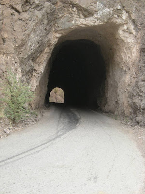
Tunnel close to Route 40 near Jachal, in San Juan.
Copyright © 2008 Austin Whittall
Copyright © 2008 Austin Whittall
Route 40 - between Rio Mayo (Chubut) and Perito Moreno (Santa Cruz), a storm at dawn over the Patagonian steppe.
Copyright © 2007 Austin Whittall
Copyright © 2007 Austin Whittall
Route 40 - two small "chapels" by the side of the road at Cuesta de Miranda (Miranda's slope), La Rioja. The road here is narrow and has plenty of cliff-hanging curves. It reaches a maximum altitude of 2,020 m (6,622 ft.).
Copyright © 2007 Austin Whittall
Copyright © 2007 Austin Whittall
Route 40 - Two Kolla women - the one that is bending over is carrying a child on her back. La Quiaca right beside the Argentine-Bolivian border.
Copyright © 2007Austin Whittall
Copyright © 2007Austin Whittall
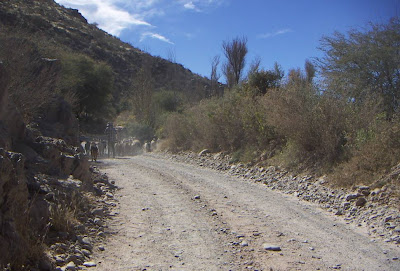
Route 40 - from Cafayate to Cachi in Salta. Goats and keeper block the road. Notice how narrow it is.
Copyright © 2007 Austin Whittall
Copyright © 2007 Austin Whittall
Route 40 - in Chubut 42° South. Close to Epuyén, Patagonia, looking along the Epuyén River valley.
Copyright © 2007 Austin Whittall
Copyright © 2007 Austin Whittall
Route 40 - at la Quiaca. Altitude is 3,445 m (11,295 ft.).
Copyright © 2006 Austin Whittall
Copyright © 2006 Austin Whittall
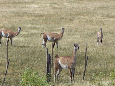
Route 40 - Guanaco by the side of the road close to Tecka, Chubut, Patagonia.
Copyright © 2007 Austin Whittall
Copyright © 2007 Austin Whittall
TravelRoute40.blogspot.com. Copyright © 2010 by A. Whittall


